
Introduction to the DJI Mavic 3E
The DJI Mavic 3E has emerged as a leading solution in the drone industry, particularly in the realm of aerial imaging and surveying. Designed with advanced technology and user-friendly features, the Mavic 3E caters to a variety of professional applications, from mapping to emergency response. Whether you are a seasoned professional or an enthusiastic hobbyist, understanding the capabilities of the Mavic 3E can elevate your aerial missions and enhance your operational efficiency. In this comprehensive guide, we will explore the intricate features, applications, and best practices associated with this innovative drone.
For those considering an investment, the dji mavic 3e provides an impressive array of functionalities that can transform how you approach aerial tasks.
What is the DJI Mavic 3E?
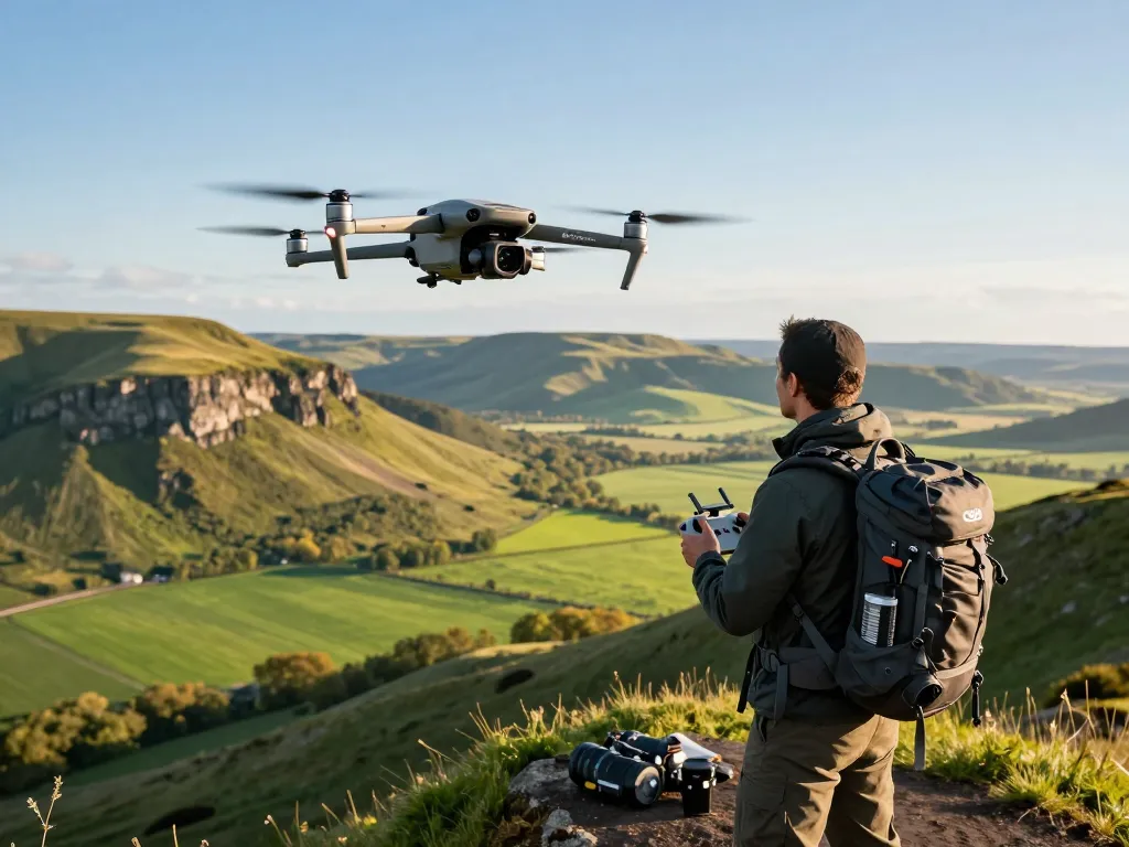
The DJI Mavic 3E is part of the Enterprise series from DJI, a well-known leader in the drone technology market. This drone is equipped with a mechanical shutter and boasts a remarkable 56x hybrid zoom camera, making it ideal for high-resolution aerial photography and intricate surveying tasks. The Mavic 3E’s compact design and advanced capabilities make it suitable for a wide array of professional environments, from construction and agriculture to emergency service operations.
Key Features and Specifications
Understanding the technical specifications of the Mavic 3E is essential for its effective utilization. Key features include:
- Camera: 20MP wide-angle camera with a 4/3 CMOS sensor.
- Zoom Capabilities: 56x hybrid zoom for detailed inspections and surveys.
- Flight Time: Up to 46 minutes of flight time under optimal conditions.
- RTK Module: Provides centimeter-level accuracy for demanding mapping and surveying applications.
- Improved Wind Resistance: Enhanced stability in challenging weather conditions.
Comparative Analysis with Other Drones
When comparing the DJI Mavic 3E to its contemporaries, it stands out due to its advanced imaging technology and flight performance. For example, when placed alongside other drones like the DJI Phantom 4 RTK, the Mavic 3E offers superior zoom capabilities and a more extended flight duration, making it a preferred choice for professionals who require maximum efficiency and detail.
Understanding the Applications of the DJI Mavic 3E
Mapping and Surveying
The Mavic 3E is revolutionizing the mapping and surveying sectors. Equipped with precision technology, it enables users to capture high-resolution images for topographic surveys, construction planning, and land assessments. The RTK capability ensures that data collected is accurate, allowing surveyors to produce reliable models and maps.
Emergency Response and Search Operations
In emergencies, every second counts. The Mavic 3E’s quick deployment and aerial capabilities make it invaluable for first responders. Its thermal imaging capabilities can assist in search and rescue missions, allowing teams to locate individuals in low visibility situations. The drone’s efficiency in covering vast areas quickly can drastically reduce response times.
Real Estate Aerial Photography
Real estate professionals benefit significantly from the Mavic 3E’s high-quality imaging. Its ability to capture stunning aerial views enhances property listings, providing a perspective that ground photography cannot match. Utilization of the 56x zoom feature allows agents to showcase large properties and land features in vivid detail, attracting more potential buyers.
Best Practices for Operating the DJI Mavic 3E
Pre-flight Checklist and Safety Protocols
Before each flight, it is crucial to conduct a comprehensive pre-flight checklist. This includes checking battery levels, firmware updates, and ensuring that the drone’s sensors are working correctly. Additionally, operators should familiarize themselves with local regulations and airspace restrictions to avoid violations and ensure safe operation.
Optimal Settings for Different Environments
Understanding how to set the Mavic 3E for various environments is vital for achieving the best results. For sunny conditions, users may need to adjust the exposure and utilize the ND filters to control light. In low-light conditions, activating the drone’s low-light mode can enhance image quality, ensuring clarity in challenging environments.
Regulatory Compliance for Drone Usage
Compliance with local regulations is essential for any drone operator. The FAA requires operators to follow specific guidelines, including maintaining visual line of sight and obtaining necessary permits for commercial use. Being aware of these restrictions not only ensures safe flight but also protects the operator from legal repercussions.
Enhancing Your Photography with the DJI Mavic 3E
Utilizing the 56x Zoom Feature Effectively
The 56x zoom feature is one of the Mavic 3E’s standout characteristics. Effective utilization requires practice; operators should learn to smoothly zoom in and out to maintain image stabilization. This feature is particularly useful for capturing details of distant objects without losing clarity.
Editing and Post-Processing Techniques
Post-processing is crucial for transforming raw images into stunning visuals. Using software like Adobe Lightroom or Photoshop can significantly enhance photos taken with the Mavic 3E. Techniques such as adjusting exposure, contrast, and color grading can make a substantial difference in the final output, allowing for professional-grade imagery.
Creating Compelling Narratives with Drone Imagery
Drone imagery can tell powerful stories, especially in real estate, tourism, and marketing. To create compelling narratives, operators should consider the flow of their shots and the emotions they wish to evoke. Planning flights to capture specific angles or events can lead to engaging content that resonates with viewers.
The Future of Aerial Photography with DJI Mavic 3E
Technological Innovations Expected by 2026
As technology continues to evolve, the future of drone photography looks promising. By 2026, we can anticipate further advancements in imaging technology, potentially including higher resolution cameras, improved AI integration for automatic shot composition, and enhanced obstacle avoidance systems, making drones even easier and safer to operate.
Market Trends in Drone Photography
The demand for drone photography is expected to rise significantly, driven by industries such as real estate, agriculture, and event planning. As the technology becomes more accessible, smaller businesses and independent professionals will increasingly utilize drones for marketing, inspections, and creative projects.
Preparing for Advanced Features and Capabilities
As innovations unfold, staying informed and adapting to new technologies is crucial for drone operators. Engaging in continuous learning, attending workshops, and participating in online communities can provide valuable insights into employing advanced features effectively and keeping pace with industry trends.